AQI
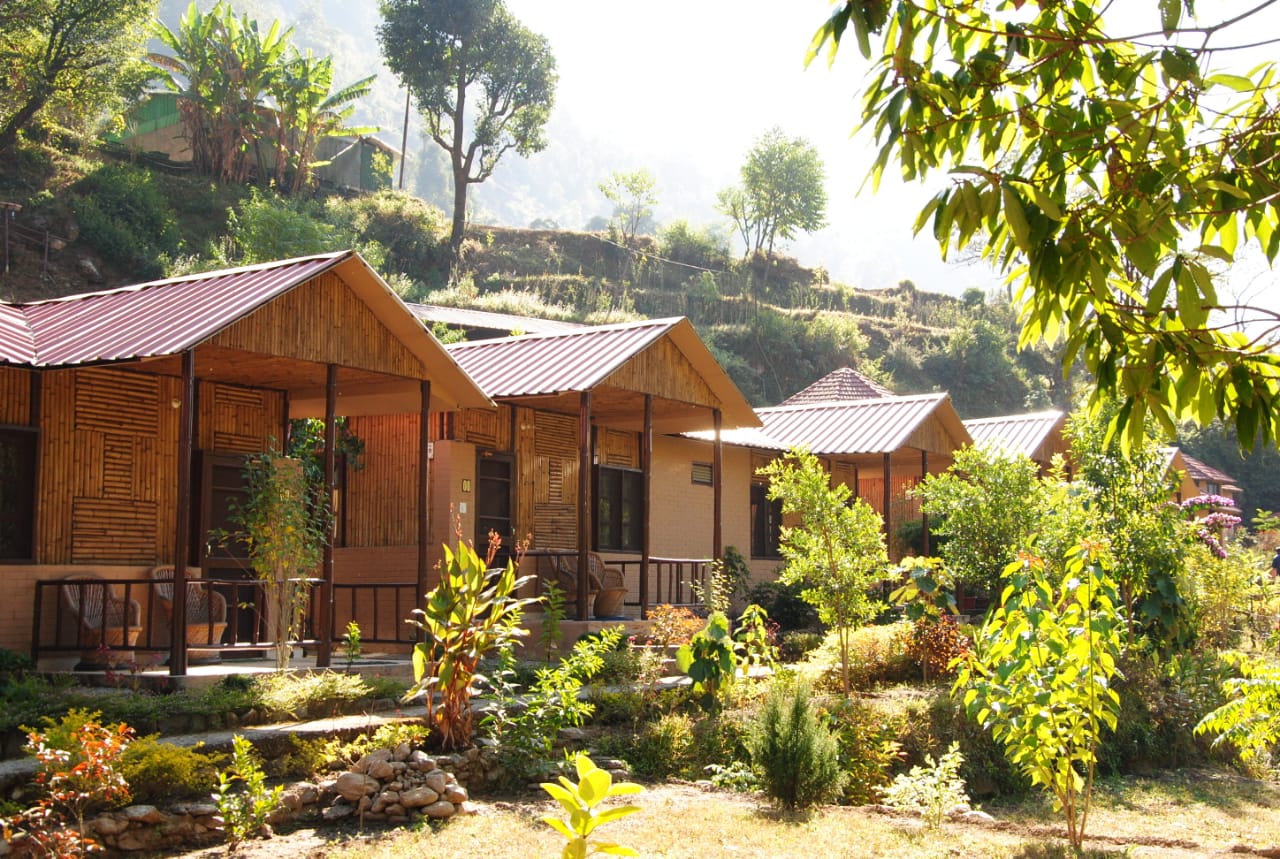
Average Nightly Rate : 3333
Tungnath, Uttarakhand, India

Tungnath, Uttarakhand, India

About the Tungnath

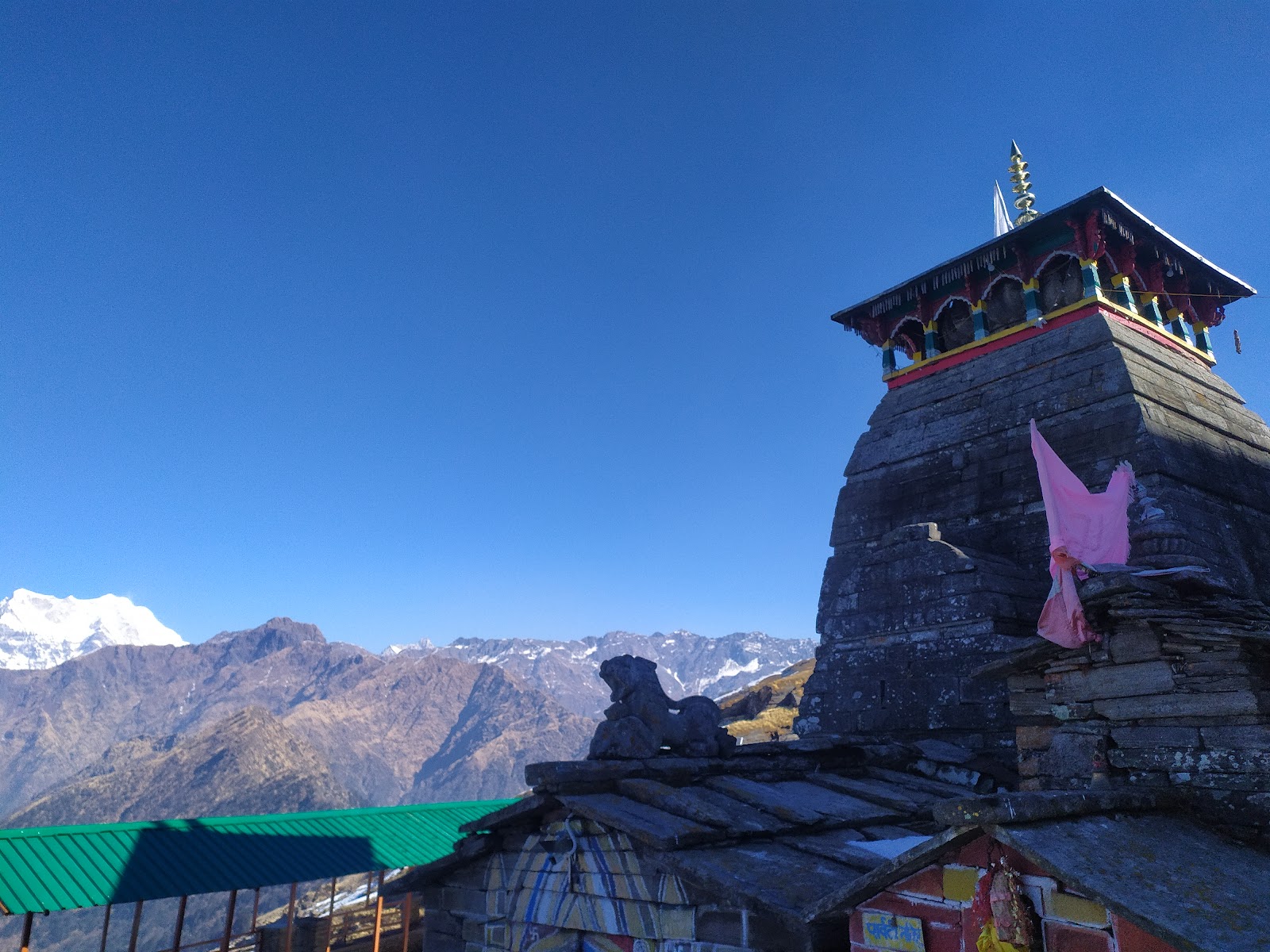
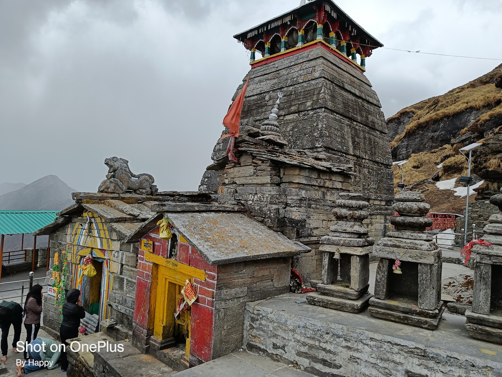
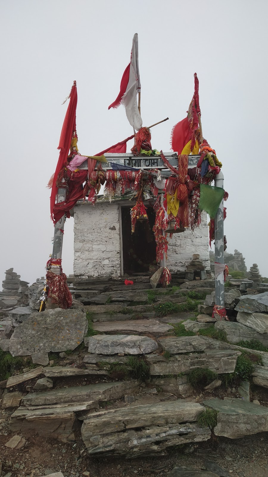
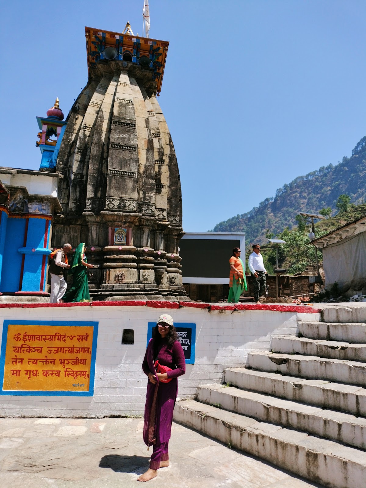
Tungnath is the highest Shiva temple in the world and one of the Panch Kedars located in Uttarakhand, India. Situated at 3,680 meters, it offers Himalayan views. The temple is believed to be over 1000 years old and is associated with the Pandavas.

Best Time to Visit

April to June (summer) and September to November (autumn). The temple remains closed during the winter months due to heavy snowfall.

Trip Duration

2 days 3 days
2-3 days (including travel to and from Chopta)

Best Tourist Places to Visit in Tungnath

Shri Tungnath Temple, Panch Kedar

4.8

Popularity

Chandrashila
Chandrashila

4.9

Popularity

Activities / Things To Do in Tungnath

  • Trekking to Tungnath Temple The primary activity is the trek to the Tungnath temple, a well-defined 3.5 km path from Chopta.
  • Visit Chandrashila Peak A further 1.5 km trek from Tungnath leads to Chandrashila peak, offering a 360-degree panoramic view of the Himalayas.
  • Attend the Aarti Participate in the evening aarti (prayer ceremony) at the Tungnath temple for a deeply spiritual experience.
  • Explore Chopta Spend some time in Chopta, the base camp for the Tungnath trek. Explore the surrounding meadows.
  • Photography Capture the stunning landscapes, snow-capped peaks, and the architecture of the temple.
  • Camping (Chopta) Camping in Chopta provides an opportunity to enjoy the night sky and wake up to the breathtaking views of the Himalayas.
  • Visit Deoria Tal Lake A moderate trek to the beautiful lake Deoria Tal, this lake provides a magical reflection of the Himalayan ranges in it's waters.

Tungnath Best Restaurant | Your Ultimate Dining Guide

Shri Tungnath Temple, Panch Kedar

4.8

Popularity

India's First Tea Shop

4.6

Popularity

Accommodation

CHOPTA The Mini Switzerland AMAR RESORT

4.5

Popularity

Chopta Magpie Jungle Camp

4.5

Popularity

Himalayan Eco Lodges, Vedant Valley, Kund

4.2

Popularity

How to Reach Tungnath

Air

The nearest airport is Jolly Grant Airport, Dehradun (approx. 210 km from Chopta).

Car

Chopta is well-connected by road to major cities in Uttarakhand. From Chopta, you have to trek 3.5 km to reach Tungnath.

Bus

Nearest motorable road is Chopta. You can hire a taxi or take a bus from Rishikesh or Haridwar to reach Chopta.

Train

The nearest railway station is Rishikesh (approx. 226 km from Chopta).

Important Notes

The trek to Tungnath can be tiring due to the altitude. Take it slow and stay hydrated.
Carry warm clothing even during summer.
Hire a porter if you have heavy luggage.
Carry essential medicines and a first-aid kit.
Respect the local customs and traditions.
Check the weather forecast before planning your trip.
Carry sufficient cash.
The temple remains closed during winter months.
Inform your family about your location.
Always carry raincoats as the weather is highly unpredictable.

Tungnath Nearby Destinations

Chopta

Chopta

A small hill station that serves as the base for the Tungnath and Chandrashila trek.

Distance : 6 KM (approx)

Rating : 4.6

Popularity Score : 4.6

Must Visit : The meadow offering stunning views, Deoria Tal (a lake accessible via a trek from Chopta).

Ukhimath

Ukhimath

Winter seat of Lord Kedarnath, a significant religious site.

Distance : 5 KM (approx)

Rating : 4.3

Popularity Score : 4.3

Must Visit : Omkareshwar Temple, winter home of Lord Kedarnath idol.

Frequently Asked Questions

Is the trek to Tungnath difficult?
The trek is considered moderate but can be tiring due to the altitude.
Are there any shops near Tungnath Temple?
Limited shops are available, mostly offering tea, coffee, biscuits, and basic snacks.
When is the Tungnath Temple open?
The temple is open from April/May to October/November, depending on the Hindu calendar.
Is it safe to trek to Tungnath?
Yes, the trek is generally safe. Be prepared for changing weather and altitude sickness.
Do I need any permits for the Tungnath trek?
Permits are not required for the Tungnath trek itself, but check with local authorities.
What type of clothing should I carry?
Carry warm clothing, including layers, even during summer. Also, pack rain gear.
Is there mobile network connectivity available?
Limited network connectivity may be available. Make sure to inform your family about your location.
What medical facilities are available?
Basic medical facilities are available in nearby towns like Ukhimath. It is better to carry your own medication.

Location Map

Coordinates: Latitude 30.4814, Longitude 79.2128 (Tungnath, Uttarakhand, India)